

On a map, the Mardi Himal Trek looks almost too simple: a single line climbing north from the hills above Pokhara to the foot of a mountain, then dropping back down. On the ground, that line passes through half a dozen distinct landscapes, from terraced farmland to cloud forest to a knife-edged grassy ridge at the edge of the Annapurna Sanctuary. Understanding how the route fits together makes it much easier to choose an itinerary, pace your days and know what to expect around each corner.
This guide describes the Mardi Himal route stop by stop, with altitudes, approximate distances and walking times, then covers the alternative starts and exits, how to navigate, and which maps and apps are worth downloading before you leave.
Where the Mardi Himal Route Sits
The trek lies in Kaski District, inside the Annapurna Conservation Area, directly north of Pokhara. It follows a long ridge that runs south from the base of Mardi Himal, a 5,587-meter peak on the southern side of Machapuchare. To the west of the ridge lies the deep Modi Khola valley, which carries the busier trail to Annapurna Base Camp. Because the Mardi route stays high on the ridge instead of down in the valley, it has open views for much of the upper section and far fewer trekkers.
The route was developed for tea house trekking only in the last decade or so, which is why older maps sometimes show it faintly or not at all. Today the lodges are well established and the trail is clear. For the bigger geographical picture, read where Mardi Himal is and how the region fits together.
The Route at a Glance
| Waypoint | Approx. altitude | From previous stop | Notes |
|---|---|---|---|
| Pokhara | 822 m | — | Starting city, permits and gear |
| Kande | 1,770 m | About 1 hour by road | Main trailhead on the Baglung road |
| Australian Camp | 2,060 m | 1 to 1.5 hours | First big mountain view |
| Pothana | 1,990 m | 30 to 45 minutes | Conservation area checkpoint |
| Pitam Deurali | 2,100 m | 1 to 1.5 hours | Common first night |
| Forest Camp | 2,600 m | 4 to 5 hours | Clearing in deep forest |
| Rest Camp | About 2,700 m | 30 to 45 minutes | Small, quiet lodge stop |
| Low Camp | 2,970 m | 1.5 to 2.5 hours | Sunset view of Machapuchare |
| Badal Danda | 3,210 m | About 1 hour | "Cloud hill", edge of the treeline |
| High Camp | 3,580 m | 2 to 3 hours | Highest overnight stop |
| Upper View Point | About 4,200 m | 2 to 2.5 hours | Popular sunrise point |
| Mardi Himal Base Camp | About 4,500 m | 1 to 1.5 hours | Highest point of the trek |
| Siding | 1,750 m | 5 to 6 hours from Badal Danda | Village at the road head |
Altitudes vary slightly between sources and signboards, so treat them as close guides rather than exact survey figures. For a fuller breakdown of kilometers and elevation gain, see Mardi Himal distance, duration and elevation explained.
Section by Section: The Ascent
Kande to Australian Camp
From the road at Kande, a stone staircase climbs through terraces and small homes to the ridge crest. It is a short but steep start of about 300 meters of ascent. At the top, Australian Camp opens into a wide meadow with lodges on its edge and the Annapurna range spread across the northern skyline. Many day hikers from Pokhara come only this far. Our Kande trailhead guide covers the start in detail.
Australian Camp to Pitam Deurali
The trail drops slightly to Pothana, a scattering of lodges where the conservation area checkpoint records your permits, then climbs gently through forest to Pitam Deurali. This part of the route is shared with trekkers heading toward Landruk and the Annapurna Base Camp trail, so you may meet other groups. At Pitam Deurali the Mardi Himal route branches off to the north, and from here the crowds thin noticeably.
Pitam Deurali to Forest Camp and Low Camp
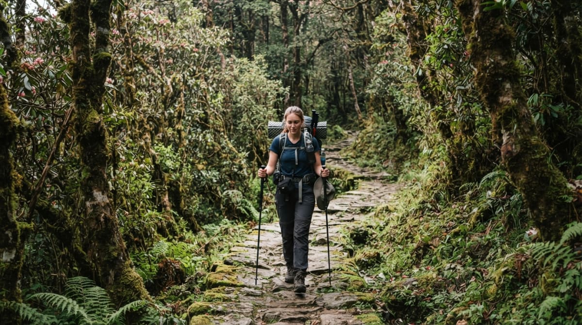
This is the heart of the forest section. The path follows the ridge through rhododendron, oak and moss-covered trees, with very little open ground. It climbs steadily rather than steeply, and there are only a few lodge stops, so it pays to carry snacks and water. Forest Camp sits in a clearing about two-thirds of the way up the forest. Beyond it, Rest Camp and then Low Camp mark the point where the trees start to thin and the views begin.
Low Camp to High Camp
Above Low Camp the ridge becomes open and the trail runs along its spine through grass and dwarf rhododendron. Badal Danda, an hour above Low Camp, is a small lodge stop that often sits right in the cloud line. The final climb to High Camp follows the narrowing ridge with steep slopes on both sides. In clear weather this is the most spectacular walking of the trek. For what the walking feels like, read Low Camp to High Camp: walking the Mardi Himal ridge.
High Camp to Base Camp
From High Camp, a steep, often frosty path climbs the ridge to the Upper View Point, then continues more gently across open slopes to Mardi Himal Base Camp. There are no lodges above High Camp, so you carry water, snacks and warm layers. Most groups leave before dawn and are back at High Camp by late morning. Our Mardi Himal Base Camp visitor's guide explains what you see at the top and how long to allow.
Descent Options and Exits
How you leave the ridge is one of the few real route choices on this trek. All of the exits start by retracing your steps to Badal Danda or Low Camp.
- Siding (most common). A steep trail drops east from the ridge between Badal Danda and Low Camp through forest and then farmland to Siding, a Gurung village where jeeps wait for trekkers. It is a long descent of around 1,400 meters. See our Siding village guide.
- Lwang. An alternative trail descends to Lwang, a village known for its tea gardens, which also has road access. It is slightly less used and makes a pleasant variation. Read Mardi Himal via Lwang village.
- Back the way you came. Returning via Forest Camp and Pitam Deurali to Kande or Dhampus is useful if the Siding road is blocked, which occasionally happens in the monsoon.
- Across to Landruk. From the lower part of the route, trails lead down to Landruk in the Modi Khola valley, where you can join the Annapurna Base Camp trail or head to the Jhinu Danda hot springs. Our guide to linking Mardi Himal with Landruk explains the options.
Alternative Starting Points
Kande is the standard start because it is the closest trailhead to the ridge with a good road. The main alternative is Phedi, a little closer to Pokhara on the same highway, from which a steep stone staircase climbs to Dhampus. From Dhampus the trail continues to Australian Camp and joins the usual route. Starting from Phedi adds a little more climbing and passes through a larger village, which some trekkers enjoy. Our comparison of Phedi and Kande covers the differences, and you can also start from the other end, as described in trekking Mardi Himal in reverse.
Total Distance and Elevation
Most trekkers walk roughly 40 to 45 kilometers in total, including the Base Camp hike and the descent to Siding. The daily distances are modest, typically 6 to 10 kilometers, but the gradients are what make the days feel full. You climb from 1,770 meters at Kande to 3,580 meters at High Camp, then add another 900 meters or so on the Base Camp hike. The descent from Badal Danda to Siding loses around 1,400 meters in a single day, which is often harder on the legs than any of the climbs.
These figures are why walking time, rather than distance, is the more useful measure when planning. Our day-by-day itinerary guide shows how the sections are grouped into days.
Navigation and Trail Markings
The main trail is obvious for most of its length. In the forest it is a well-trodden dirt and stone path with occasional painted markers on rocks and trees. On the open ridge it becomes a clear line through the grass. The tricky conditions are fog and snow. The upper ridge can disappear into cloud within minutes, and after snowfall the path above High Camp can be hard to see. Side trails used by herders and villagers also branch off in the lower sections.
Since 2023, foreign trekkers in Nepal have been required to trek with a licensed guide, and on a route like this the rule makes practical sense. A guide knows where the path runs when visibility drops and which sections become icy. Our article on trail markings and navigation explains what to watch for.
Maps and Apps Worth Using
You do not need to navigate yourself, but having a map adds to the experience and helps you follow the day's plan.
- Printed maps. Trekking maps of the Annapurna region are sold in bookshops and gear shops in Pokhara's Lakeside and in Thamel in Kathmandu. Look for one that shows the Mardi Himal ridge clearly, as some older editions only show the Annapurna Base Camp trail.
- Offline map apps. Apps that use OpenStreetMap data, such as Maps.me, OsmAnd and similar, show the main Mardi Himal trail and lodge stops. Download the region before you leave Pokhara, because mobile data is patchy on the ridge.
- GPS tracks. If you like recording your hike, a phone GPS app or a watch will work fine. Keep your phone warm at High Camp, as cold drains batteries quickly.
We compare the options in offline maps and GPS apps for Mardi Himal.
Checkpoints and Permits Along the Route
You pass through the Annapurna Conservation Area for the whole trek, so you need an ACAP entry permit, and your permit details are recorded at a checkpoint in the lower section of the route. Keep your permits somewhere easy to reach on the first day. If you are trekking with us, your guide carries the paperwork and handles the checks. Read where permits are checked on Mardi Himal for details.
How the Route Changes with the Seasons
The route itself does not change, but conditions do. In autumn the trail is dry and firm. In spring the forest is in bloom and the lower sections can be dusty. In the monsoon the forest trail becomes muddy and slippery, and leeches are common below Low Camp. In winter, snow and ice can cover the ridge above High Camp and sometimes the section between Badal Danda and High Camp, and microspikes become essential. Our guide to trail conditions on Mardi Himal goes season by season.
Route Highlights Not to Miss
Because the route is short, it is easy to rush past some of its best moments. A few places deserve extra time:
- Australian Camp in the early morning. If you start early, the meadow often has clear views of the whole range before the haze builds.
- The forest above Pitam Deurali in April. The rhododendrons here bloom in red, pink and white, and the section is quiet enough to hear birds calling through the canopy.
- Low Camp at sunset. Machapuchare sits directly in front of the lodges, and the last light turns its summit orange.
- The ridge between Badal Danda and High Camp. This is where the trek feels most like a high mountain journey, with steep drops on both sides and a view that widens with every step.
- The Upper View Point at sunrise. Even if you continue to Base Camp, stop here to watch the first light hit Annapurna South and Hiunchuli.
Our list of hidden gems on the Mardi Himal trail suggests a few quieter spots as well.
Walking the Route with Us
All of our Mardi Himal trips follow this route, with the nights spaced to suit the length of the trip. The 5-day Mardi Himal Trek from Pokhara covers the full ridge from Kande to Base Camp and exits via Siding, with transport, permits and a licensed guide included. If you are coming from Kathmandu, the 9-day Mardi Himal Trek adds the city days and the journey to Pokhara. Either way, your guide will know every junction, lodge and shortcut on the ridge, so you can spend your attention on the views.